

Huge quantities of productive land lost to development, our research shows
20 July
Farmland that could grow 250,000 tonnes of vegetables a year lost to development, CPRE research shows
• Two million fewer people can be fed their five a day from vegetables homegrown in England as prime farmland lost to development
• Food security concerns increase, with 60% of England’s finest agricultural land at the highest risk of flooding from climate change
• Nearly 300,000 homes have been built on prime farmland, with an extra 1,400 hectares used for renewable energy projects – despite more than enough previously developed brownfield land waiting for regeneration
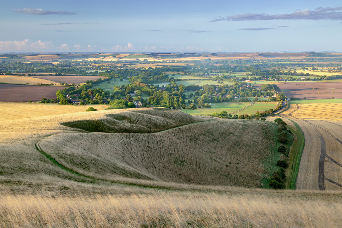
England’s future food security has been called into question after losing farmland capable of feeding the combined populations of Liverpool, Sheffield and Manchester their five a day. New research by CPRE, the countryside charity, found almost 14,500 hectares of the country’s best agricultural land, which could grow at least 250,000 tonnes of vegetables a year based on typical yields, has been permanently lost to development since 2010.
There was an exponential rise in Best and Most Versatile (BMV) agricultural land set aside for housing and industry between 2010 and 2022, from 60 hectares to more than 6,000 hectares per year. Almost 300,000 homes were built on more than 8,000 hectares of prime farmland. This is despite there being space for 1.3 million homes to be built on more than 26,000 hectares of previously developed brownfield land, much of it disused and derelict urban patches of the midlands and north most in need of regeneration.
The increased risk of severe flooding caused by climate change will further challenge food security in future. More than 200,000 hectares – or 60% – of England’s finest Grade 1 agricultural land is within areas at the highest risk of flooding, known as Flood Zone 3. Our most productive farmland is disproportionately close to river and coastal flood plains, with 75% of BMV in the East Midlands and 95% of BMV in the east of England at the highest risk of flooding.
That is why CPRE is calling on the government to introduce a comprehensive, cross-departmental land use strategy. It must provide a planning framework to balance the competing and often conflicting demands for farming, housing and energy needs on a finite amount of land, while also meeting legally binding net zero targets. The National Planning Policy Framework, which is due to be updated next year, should prioritise a ‘brownfield first’ approach to housebuilding, with a preference for medium- and higher-density units to help protect our most valuable agricultural land wherever possible. There should be a firm presumption against development on BMV land.
Crispin Truman, chief executive of CPRE, the countryside charity, said:
‘For the first time in several generations, our food security is at risk – yet we’ve seen a 100-fold increase in the loss of our best farmland to development, since 2010. Heating, eating and housing are fundamental needs. A healthy environment, mitigating and adapting against the devastation threatened by the climate emergency, is the bedrock that underpins them all. We need to know what to put where. That’s why we need a land use strategy.
‘Maintaining agricultural land for domestic food production is critical. This must be achieved in the context of addressing and adapting to climate change, reversing the loss of nature and increasing demands on land for other purposes, not least housing and production of renewable energy.
‘As we face a cost-of-living crisis, housing crisis and the adjustment of our farming sector to post-Brexit subsidies, we have multiple, critical priorities for our land. We need to move away from intensive farming practices and towards a more ‘multifunctional’ approach, reconciling food production with better management for natural and cultural heritage, and for public access. Policies which are put in place now will be crucial in the coming years to ensure the most efficient use of our land in the face of these challenges.’
CPRE’s report on the loss of agricultural land is believed to be the first ever to quantify the scale of development nationally on the two highest and most productive grades of farmland. The east of England has seen high levels of development on BMV land, with over 3,200 hectares lost over the past 12 years. This is followed closely by the South East region, with almost 3,000 hectares of BMV land disappearing overall, and the greatest loss to development of Grade 1 land, which is rated excellent quality.
A further 1,400 hectares of BMV land was taken out of agricultural production for renewable energy projects in the same period. CPRE estimates that this land produces less than 3% of the UK’s total installed solar capacity, or 0.3GW out of 14GW, suggesting it’s entirely possible for the government to balance managing both food and energy security, particularly if rooftop solar is prioritised.
Climate change is likely to have severe consequences for our most valuable farmland and an increased threat to food security. Protecting our most productive agricultural land from permanent development now is vital if we are to maintain a secure food supply in future.
ENDS
For further information or to interview a spokesperson, please contact:
Sam Relph, CPRE Media Relations Lead, at samr@cpre.org.uk or 020 7981 2827 / 07739 332796
NOTES TO EDITORS:
Download a copy of the report here.
While all our land is of great value and potential for different reasons, the planning system’s ‘Best and Most Versatile’ (BMV) classification is given to our agricultural land that is regarded as the most productive in terms of its food producing potential. BMV land was first classified in response to the demand for self-sufficiency following the Second World War through the identification of the nation’s most productive lands. Land is identified as BMV (either Grade 1, 2 or 3a; there are five grades altogether) using the Agricultural Land Classification (ALC). The mapping of agricultural land is maintained by Natural England. Land which is classified as one of these three grades is determined as the most flexible in the range of crops which can be grown, while also requiring lower inputs to produce high crop yields.
The Best and Most Versatile agricultural land grades:
• Grade 1: excellent quality agricultural land – land with no or very minor limitations and yields are high and less variable. A very wide range of agricultural crops can be grown such as: apples and pears / salad crops / soft fruit like berries / winter harvested vegetables
• Grade 2: very good quality agricultural land – land with minor limitations that affect crop yields, cultivations or harvesting. Generally high yielding land but may be lower or more variable than Grade 1.
• Grade 3a: good quality agricultural land – land which can consistently produce moderate to high yields of a reduced variety of arable crops, such as: cereals / sugar beet / potatoes.’
Methodology:
Development on BMV land analysis: To understand the quantities of BMV land which have been built on since 2010, we used several spatial datasets from Natural England and a development dataset obtained from development consultancy, Glenigan. The majority of information on the ALC Grade of soils throughout the country is based on the old system which does not include Grades 3a and 3b, instead places both of these Grades into an aggregated Grade 3. Using GIS tools and the Post 1988 dataset, we were able to determine which developments in our dataset fell into Grade 3a land, and as a result could be considered BMV for our findings. It should be noted that the post 1988 dataset covers only 8% of rural England, and as a result, we were only able to identify 3% of the Grade 3 land which fell into Grade 3a or 3b.
Appeals analysis: During April 2022, CPRE collated inspector reports from planning appeals platform, Compass. A key word search was conducted using the phrases ‘BMV’ and ‘Best and Most Versatile’ to identify the relevant appeals.
Flooding risk analysis: To assess the risk to faced by BMV to Flooding, CPRE used the existing ‘Provisional’ mapping dataset and the Environment Agency’s flood risk for planning, flood zone 3 datasets, to understand where areas of BMV land were falling in relation to high flood risk areas. Using GIS tools these two spatial datasets were overlaid, and the intersect between flood zone 3 and Grade 1 areas was measured.
Solar energy production: There are currently 14GW (gigawatts) of solar power installed in the UK. Using Carbon Trust and Energy Saving Trust data, we estimate that 1GW of capacity supplies 8TWh (terawatt hours) of energy per year, so installed solar capacity is supplying about 112TWh. The 1,400 hectares of solar installations on BMV land should produce around 2.8TWh, which is 2.5% of current installed solar capacity.