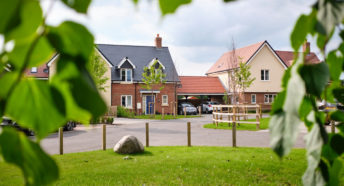
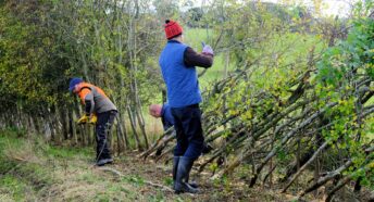
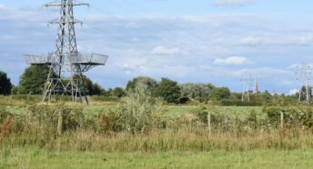
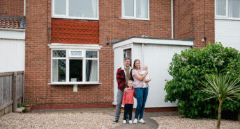
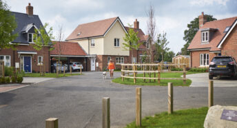
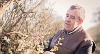
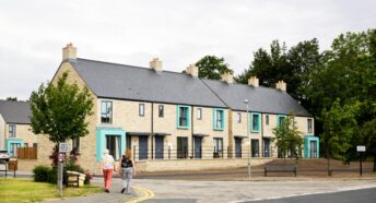
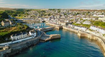
Government's record on Green Belt fails to match the rhetoric
26 November 2007
Countryside campaigners, the Campaign to Protect Rural England (CPRE) [1], have learned that an area of Green Belt land the size of central London has been lost across England since 1997.
New Government figures [2] show that the amount of greenfield land in the Green Belt being lost to development across England is significantly higher than previously thought. Before these figures were published, the average annual rate of loss since 1997 was calculated as 845 hectares, the new figure is 1,100. According to the new information, 66 sq km of Green Belt land was lost between 1997 and 2003, an area the equivalent to central London or 9,900 football pitches.
Paul Miner, CPRE planning campaigner, said:
‘Despite repeated pledges by Government that Green Belts would grow in every region [3] these new figures show that Green Belt land is being developed at an alarming rate. Some new Green Belt land has been designated across England but in many places it has been reduced. Where the Green Belt is located remains as significant as how much of it we have - by shifting its boundaries the Government is encouraging urban sprawl.’
Since 2004, the Green Belt has shrunk in London and the South East, East Anglia, the North West and the East and West Midlands. CPRE estimates that proposals in the pipeline in draft regional plans threaten at least a further 4,000 hectares and the total area threatened by development is set to grow as a result of the Government’s plans to expand housebuilding and major airports.
– END –
NOTES FOR EDITORS
1. CPRE, the Campaign to Protect Rural England, is a charity which promotes the beauty, tranquillity and diversity of rural England. We advocate positive solutions for the long-term future of the countryside. Founded in 1926, we have 60,000 supporters and a branch in every county. President: Bill Bryson. Patron: Her Majesty The Queen.
2. OVERALL GREEN BELT LAND COVERAGE (hectares)
| 1997 | 2003 | 2004 | 2006* | |
| ENGLAND | 1,652,300 | 1,671,400 | 1,678,200 | 1,631,800 |
| Cambridgeshire | 26,690 | 26,690 | 26,750 | 26,302 |
| EAST MIDLANDS | 79,710 | 79,520 | 79,480 | 78,900 |
LONDON / SOUTH EAST / Bedfordshire / Essex / Hertfordshire | 600,320 | 600,470 | 601,410 | 553,886 |
| NORTH EAST | 53,410 | 66,330 | 71,910 | 71,910 |
| NORTH WEST | 255,760 | 260,610 | 260,590 | 260,310 |
| SOUTH WEST | 105,900 | 105,950 | 105,950 | 106,330 |
| YORKSHIRE AND THE HUMBER | 261,350 | 262,640 | 262,640 | 264,930 |
*The above total for Green Belt in England in 2006 excludes the 47,300 ha of former Green Belt in the New Forest which was re-designated as National Park.
Source: DCLG Green Belt Statistics. Based on the latest figures available, i.e. the figures for 1997 coverage were revised in the 2003 Government statistical bulletin.
Losses of Green Belt land in 2006 were registered in East Anglia (Cambridge, South Cambridgeshire), the East Midlands (Gedling, NE Derbyshire, Rushcliffe, S Derbyshire), London / wider South East (Broxbourne, Dartford, West Oxon), North West (Macclesfield, Sefton and Wigan); South West (South Gloucestershire, West Wilts), West Midlands (Birmingham, Bromsgrove, Stratford on Avon, Tamworth, Wychavon), Yorkshire and the Humber (Calderdale, City of York).
3. In 2003, John Prescott MP told Parliament: ‘Today, I give the House a guarantee to maintain or increase Green Belt land in every region in England’. In the Parliamentary debate following the Queen’s Speech on 8 November, 2007, the Rt Hon Hazel Blears MP indicated that Green Belt protection would remain in place, following on from earlier statements by the Prime Minister.

